The Inca Road and the Quipu — How an Empire Without Writing Ran
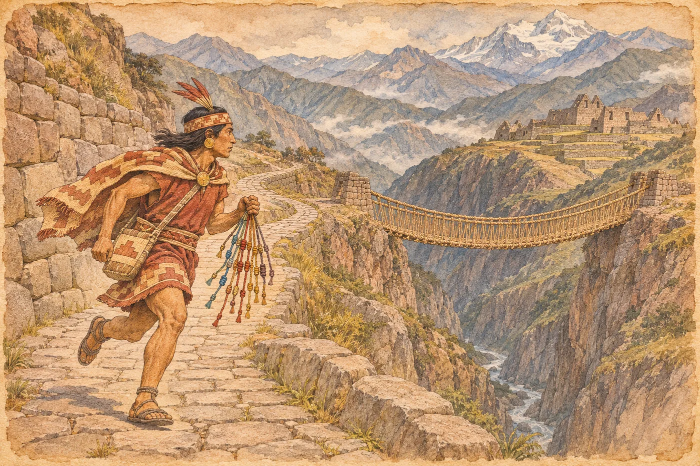
How did the Inca, who are said to have had no writing system, govern such a vast realm?
The Inca people called their realm Tawantinsuyu (Land of the Four Parts). It was a vast territory spanning the Andes mountains and the coast. However, the Inca are said to have had no writing system as we think of it. Even so, the state collected taxes and moved armies. Supporting this system were roads and knotted-cord records. As discussed later, there is debate over whether they truly lacked writing.
Those roads are called the Inca Road (Qhapaq Ñan). The total length is sometimes given as over 40,000 km, but estimates range from between 20,000 and 30,000 km to nearly 60,000 km. The roads mainly consisted of two north-south trunk lines, one along the coast and one through the mountains, with suspension bridges across valleys and stone stairways. The Andean road system is registered as a World Heritage site. Please take the varying figures as rough guides.
Running along these roads were messengers called chasquis. Runners stationed at set intervals passed goods and messages from one to the next. It is said that a fresh runner was stationed every 6–9 km, and information could travel about 240 km in a day. About every 20 km along the road, there were tambos (lodging stations) where soldiers and officials could rest and food was stored. Thanks to this well-organized relay system, messages reached across the vast empire.
Carrying the content of the messages was the quipu (knot-cord). This was a record made by tying knots in cords; colors, cord types, and knot shapes are thought to have represented numbers. It is well known that quipus were used for censuses and tax records. Chasquis are said to have carried quipus and supplemented them with oral explanations, but the exact method of use remains speculation even in historical sources, and the details are unknown. Even the color of a cord is thought to have had meaning.
Whether the quipu was a form of writing is debated among researchers. For a long time, the dominant view was that it was a numerical accounting tool. On the other hand, there is a theory that non-numerical elements—colors and knotting methods—might have conveyed narrative-like information. About 1,000 quipus are said to survive today, and much remains undeciphered. This is a great mystery that continues to be studied.
At the end of the Inca Road lie mountaintop ruins like Machu Picchu. It is believed to have been the private estate of the emperor Pachacuti, and has traditionally been thought to have been built around 1450, after Pachacuti's accession. A 2021 radiocarbon study suggested it may have been built around 1420. Spanish forces invaded the empire in 1532, entered the capital Cusco the following year in 1533, and the empire is said to have ended in 1572.
Mini timeline
- c. 1420–Machu Picchu may have been built (traditional date is c. 1450)
- 15th centuryThe Inca expand their power and develop the road network
- 1533Spaniards enter Cusco, the Inca capital
- 1572The last resistance ends, and the empire is said to have fallen
People in this chapter
He is said to have expanded the empire in the 15th century, and Machu Picchu is described as his royal estate.
They are said to have run along the roads, passing messages and goods.
Meanwhile, elsewhere
Connection to Japan
Around the same time, Japan moved from the Muromachi into the Sengoku period. In 1543 (Tenbun 12), firearms were introduced, and in 1573 (Tensho 1), the Muromachi shogunate ended.
Why it still matters
The Andean road system is a World Heritage site, and some sections can still be walked today. Near Machu Picchu, stone steps and bridges remain, visited by many people.
Perspectives differ
- Length of the road network
- Some sources say about 40,000 km, while estimates range from twenty-odd thousand kilometers to nearly 60,000 km. The number varies depending on what is counted as a road. Here it is given as a range.
- Was the quipu a form of writing?
- The view that it was a numerical record was dominant for a long time, but because it contains non-numerical elements, there is also a theory that it was a form of writing representing words. One researcher admits it is difficult to read, and narrative quipus have not yet been deciphered. There are various theories.
- Date and purpose of Machu Picchu
- Based on colonial-era documents, it was thought to have been built around 1450. A 2021 radiocarbon study suggested a possible date of around 1420, but this was based on human bones, not direct measurement of the stonework. Its purpose is commonly explained as a royal estate, but this is not certain.
Facts checked (8, verified by AI on the web)
- Confirmed The road network is said to exceed 40,000 km, with two north-south trunk lines, and is a UNESCO World Heritage site World History Encyclopedia(事典): The Inca Road System
Confirmed in an encyclopedia for 'over 40,000 kilometres' and UNESCO listing. The range of 20,000s to nearly 60,000 km is from a search summary (unverified), written to indicate the existence of a range. - Confirmed Chasquis had relay stations every 6–9 km, and information traveled up to 240 km per day. Tambos every ~20 km World History Encyclopedia(事典): The Inca Road System
Confirmed in the encyclopedia text. - Corrected & confirmed Quipus used colors, cords, and knots to represent numbers and aided the memory of road runners World History Encyclopedia(事典): The Inca Road System
Encyclopedia says 'probably used'. The point about chasquis carrying quipus is based on the encyclopedia, but oral supplementation is not in the text (unverified). - Confirmed Debate on whether quipus are writing (accounting theory, Urton's theory; the number of extant quipus is given as about 600 to 1,000 depending on the source) String and Knot, Theory of Inca Writing (Toronto Metropolitan University)
Confirmed in the page text. However, the article is old, and current research status is unverified. - Confirmed Machu Picchu traditionally dated to c. 1438; a 2021 study suggests c. 1420; royal estate; 26 bones were tested Tulane University News: Machu Picchu is older than historians thought
Confirmed in the text. Occupation until c. 1530. - Confirmed Tawantinsuyu means 'Land of the Four Parts' World History Encyclopedia(事典)「Inca Civilization」
Inca Civilization text confirms the name means 'Land of the Four Quarters.' - Confirmed Spaniards entered Cusco in 1533, the empire ended in 1572 / The Inca are said to have had no writing World History Encyclopedia(事典)「Inca Civilization」
Timeline on the same page confirms Pizarro took Cusco in November 1533. 1572 is noted as the year Vilcabamba resistance continued; SUNY Lumen (courses.lumenlearning.com/suny-worldhistory/chapter/the-spanish-conquest/) confirms Vilcabamba fell in 1572 and the last Inca emperor Túpac Amaru was killed. No writing system, used quipu, confirmed in the page's FAQ. - Unverified Contemporary events: Gutenberg, Japanese firearms arrival in 1543 (Tenbun 12), etc. World History Encyclopedia(事典): The Inca Road System
No relevant description found in accessible sources (contemporary events in Japan and Europe).
Sources
World History Encyclopedia(事典): The Inca Road System
Tulane University News: Machu Picchu is older than historians thought
String and Knot, Theory of Inca Writing (Toronto Metropolitan University)
* AI-drafted and cross-checked; human review is in progress. Status: